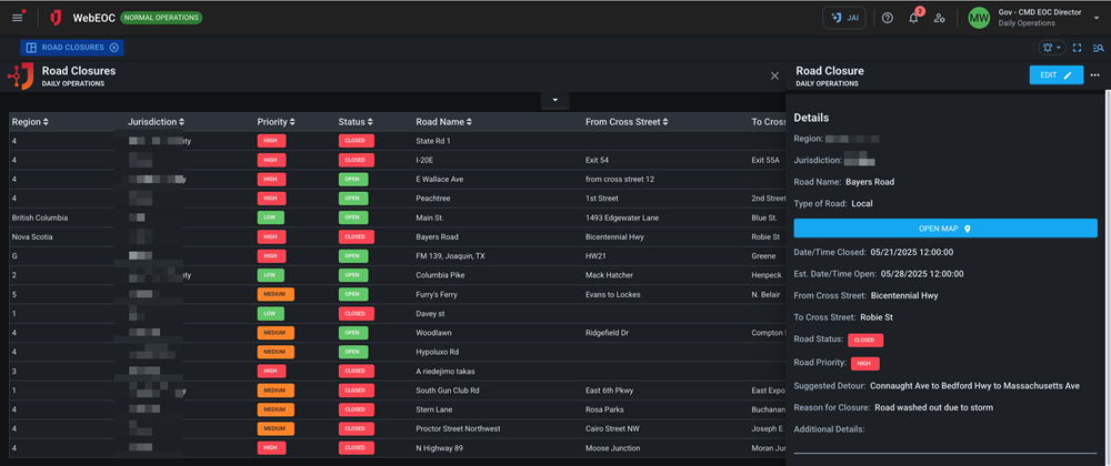
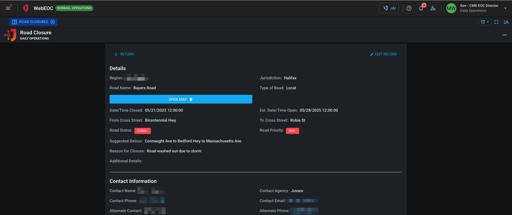
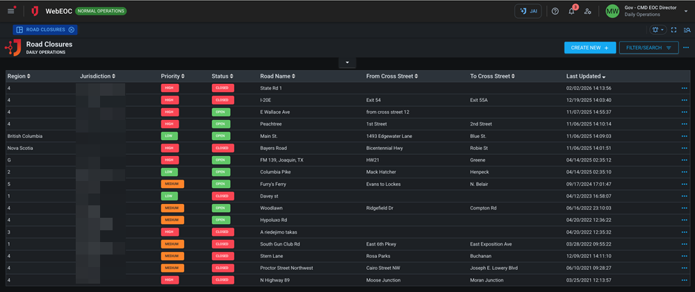
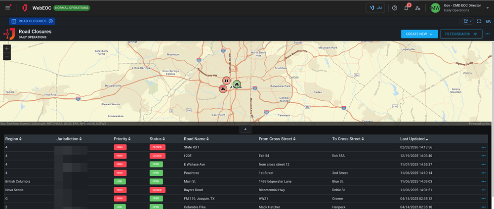
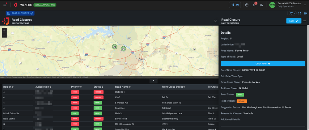
Road Closures 
Industry boards require a license key to import. Once they are imported, they cannot be exported. Contact your Client Success Manager (CSM) for more information.
The Road Closures board is a map-enabled board that helps you document and track details about road closures, including a closure’s status, location, reason for closure, and suggested detours.
For more details about this board, watch the Road Closures Training Video ![]() .
.
Your Juvare product login does not grant access to the Juvare Training Center. To view the training video, please create a separate account on the Juvare Training Center site.
Key Capabilities
-
Track road closures to help provide situational awareness for stakeholders.
-
Easily map road closures to overlay them with other critical data such as shelters and facilities.
.png)
.png)
This board has dark mode capability.
Dark mode must be enabled for your instance so that users can turn it on. See Enable Dark Mode for details.