Add an Area of Concern
You can add an Area of Concern (AOC) by manually drawing it, uploading a shapefile, or uploading a GeoJSON file.
You can use an Area of Concern to add preconfigured tasks. See Assign a Preconfigured Task to an Incident. If you want to add a resource location that can be reused for other incidents, instead use the Locations module.
To draw an Area of Concern
-
On the upper left, click Add and select Area of Concern.
-
Enter a Name and Description.
-
On the map, locate the structures relevant to the selected incident.
-
Click Draw and choose a shape to draw an AOC with.
If you need to precisely exclude certain structures, use the Polygon or Freehand Polygon options.
-
On the map, draw a shape for the AOC containing all relevant structures.

-
To adjust the shape, click Edit. Click and drag the circles on the edge of the shape to reshape the AOC.
-
For Color, click the color sample to adjust the shape's color.
-
Click Save.
To upload an Area of Concern file
-
On the upper left, click Add and select either:
-
Upload AOC Shapefile or
-
Upload AOC GeoJSON.
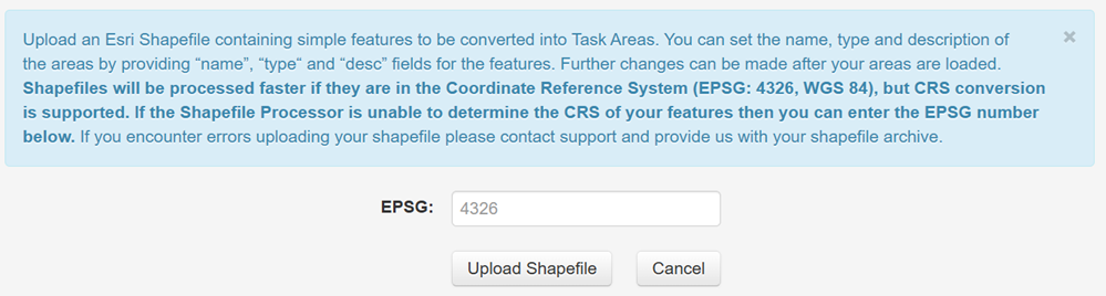
The ESRI or GeoJSON upload screen displays.
-
-
Click Upload Shapefile or Upload File (for GeoJSON files) then select the file from the file browser window.
If the shapefile or GeoJSON processor is unable to determine the Coordinate Reference System (CRS) of your file, you can enter the EPSG number manually instead.
A new area of concern is created with the boundary defined by the uploaded shapefile or GeoJSON file.
Importing a polygon shape that contains too many vertices can cause the map, including map layer interaction, to become unresponsive.