Crisis Track 4.7 Release Notes
These notes describe updates introduced in the Crisis Track 4.7 release, which occurred on Sunday, March 23, 2025. More information is available in this help center or by contacting the Juvare Support Center at +1 (877) 771-0911 or support@juvare.com.
New Features
Map Updates
This release includes many updates to the maps displayed throughout Crisis Track:
-
Redesigned the left pane to make it easier to find information and show or hide map elements.

-
Added support for additional types of map services, including web map tile services (WMTS) and Esri's vector tile services. For the full list of supported map services, see Map Layers.
-
Added more support for map services in the mobile app.
-
Added a new error icon
 to the left pane that appears if there is an issue with a map layer. You can hover over the icon for a description of the issue.
-
Redesigned the Add Map Layer window. It now displays the type of map service used for each layer, and you can use the up arrow
 or down arrow
  buttons to place map layers above or below each other.
-
Added enhancements and resolutions for map layer legends.
-
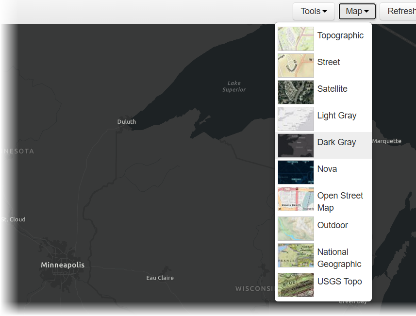
Added new options to the Map menu to change the appearance of the base map, including Dark Gray, Nova, and Outdoor.
-
Redesigned the navigation for the Timeline and Charts panes. You can now view them by clicking the Timeline or Charts text on the bottom and right sides.
-
Improved the consistency in map features and functionality across different modules.
For more information about maps and preconfigured map layers, see Operations View Module, Map Layers Module, and the other pages in those sections.
Due to the extent of these map updates, we recommend you review any map layers you previously added to Crisis Track. If a layer is not working as expected, you may need to remove it and add it again.
Tokens for Protected Map Services
If you use protected map services to add map layers, you can now save access tokens for those services. This allows you to access the map layer repeatedly without logging in again until the token expires. For more information, see Map Layers.

New Incident Status—Viewable
In the Incidents module, administrators can now set the incident status to Viewable. People can open Viewable incidents, but they cannot edit anything in the incident.

Both Viewable and Active incidents are displayed in the Existing Incident menu on the Crisis Track homepage. Viewable incidents are labeled as "View Only" in this menu and on the incident homepage.
Export Tracks to Excel®
In the Tracks module, you can now export information about the tracks on the map to an Excel® file. Previously, you could only export this information to a shapefile. On the left pane of the Tracks page, you can hide tracks to prevent them from being exported.


Enhancements
-
Structures Module: In the Structures module, the Table page now displays the date of the most recent structure data refresh on the lower right.
-
Create Incidents: When you create an incident on an account that uses jurisdictions, the Employees and Equipment pages now display the jurisdiction's name for each employee or equipment.
Resolution
Photo Notes Display: Resolved an issue that prevented notes added to photos from displaying in the Photos module, Entries module, and exported PDFs.
Help Updates
The header, footer, and side panel in the Crisis Track Help Center have been redesigned. You can now click the feedback icon ![]() on the upper right to send feedback about the Help Center.
on the upper right to send feedback about the Help Center.
Previous Versions
Release notes for previous versions are available here.