MapTac
MapTac allows administrators to publish an image file of a map, dispersion model, digital photo, or other item from any map/GIS source or digital camera. MapTac maps are published in JPEG, GIF, or PNG formats. Publishing takes place in the Admin View.
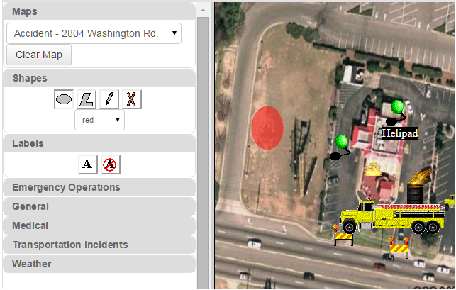
Similar to maps, administrators add marker images (JPEG, GIF, or BMP) to the database and then configure them in the Admin View. Markers include items such as push pins, emergency vehicles, roadblocks, and more. During configuration, URLs can be added to them, which allow users to gain access to related information.
In addition to general map icons, MapTac includes Department of Homeland Security (DHS) symbols that many emergency management agencies consider the standard. Administrators can add custom icons or icons specific to an agency as needed.
After an administrator publishes a map, users access it (in Plug-Ins, in the main menu) and work with the MapTac palette to add the configured markers and labels. The palette provides tools to add shapes and polygons to mark hot zones or other areas of interest without having to add them as data to a board.
Permissions for interacting with MapTac maps (Edit Markers or View Only) are configured in the Admin View.